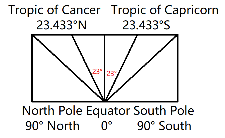
Why are the tropics at 23°? It is not because we live on a spinning ball tilting at 23°
The equator is the base line because it is the midpoint between the farthest the sun travels in both directions. From the equator, the sun is directly above during the transitional phase between the solstices known as the equinoxes. That point of the sun being directly above the equator at noon time is considered 0°.
As the suns orbit tightens around the north pole, from the equator it is measured that the sun traveled 23° North of the baseline 0°. The circle of land that observes the sun to be directly above them when the sun is at this furthest point from the equator (north) that it travels has been termed the Tropic of Cancer.
The sun then expands it’s orbit to pass back over the equator then continue 23° south to the position where the sun is viewed directly above at noontime termed the Tropic of Capricorn.
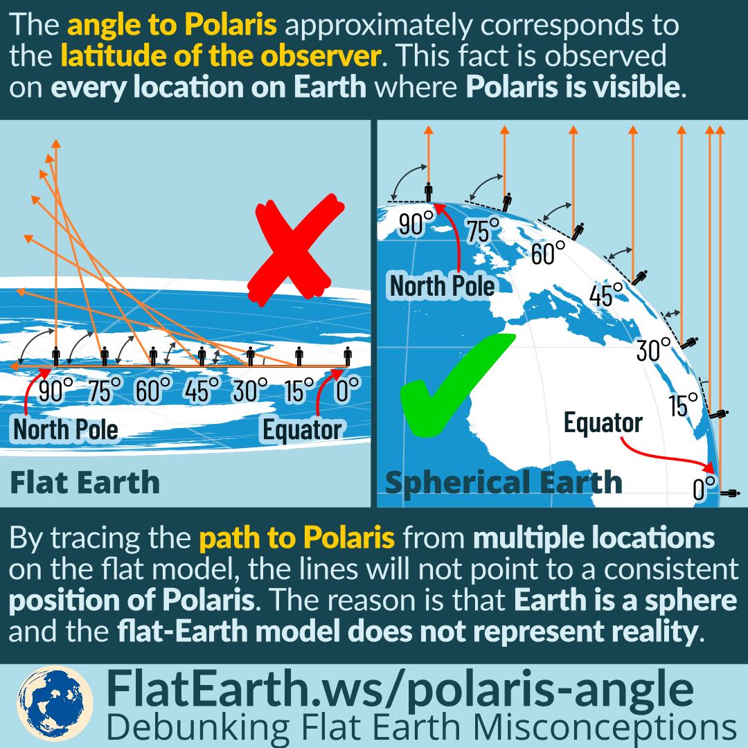
These degrees are based on the degrees the sun moves in relation to the 0 point of the equator and not based off of relation to Polaris as this demeaning infographic represents. Plus Polaris is directly able the north pole, so all of the lines sticking out perpendicular to the spherical earth creating the different angles are not all pointing directly above the north pole (towards Polaris). I guess rather than north being the magnetic north pole, to globe believers north is straight up (the sky) because that is what this picture is representing ^_^ So the “dumbass” flat earth troll image should be a bunch of lines perpendicular to the earth but showing how all of them would from a 90° from the land to this imaginary line drawn since the baseline would not be arching.